j31 SityTrail > Randonnées > Outdoor > Italie > Sicile > Enna > Piazza Armerina SityTrail > Randonnées > Outdoor > Italie > Sicile > Enna > Piazza Armerina j31 DUPORT16 Utilisateur 3D © OpenStreetMap contributors Longueur 117 km Altitude max 829 m Dénivelé positif 1590 m Km-Effort 140 km Altitude min 6 m Dénivelé négatif 2141 m Boucle Non Date de création : 2022-05-08 16:57:41.68 Dernière modification : 2022-06-02 12:38:49.875 (0 Avis) Voiture 1h11 Difficulté : Très facile Application GPS de randonnée GRATUITE SityTrail IGN / Instituts géographiques SityTrail World Le monde est à vous À propos 
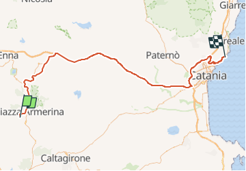
Randonnée Voiture de 117 km à découvrir à Sicile, Enna, Piazza Armerina. Cette randonnée est proposée par DUPORT16. Légendes | Plus de détails (PDF) Profil altimétrique Légendes > 15% 15% - 10% 10% - 5% à plat 5% - 10% 10% - 15% 15% - 30% > 30% Localisation Pays : Italie Région : Sicile Département/Province : Enna Commune : Piazza Armerina Localité : Unknown Départ:(Dec) 37.36809373368046 / 14.334089756011965 Départ:(UTM) 441036 ; 4135915 (33S) N. Commentaires Veuillez vous connecter pour laisser un commentaire ou une note Randonnées à proximité jcm17 acireale Voiture Très facile Piazza Armerina, Sicile, Enna, Italie 125 km | 145 km-effort 2h 22min Non jcm17 Casale Marche Facile Piazza Armerina, Sicile, Enna, Italie 2 km | 2,3 km-effort 1h 54min Oui